How we got here: The role of transportation in Fort Wayne’s growth
From portages and streetcars to highways and subdivisions, transportation shaped the way Fort Wayne grew.
This story is part of Moving Fort Wayne Forward, a year-long reporting effort to engage residents, employers, and community leaders of Greater Fort Wayne around the possibility of a more modern, multimodal transportation system. Read the full series here.
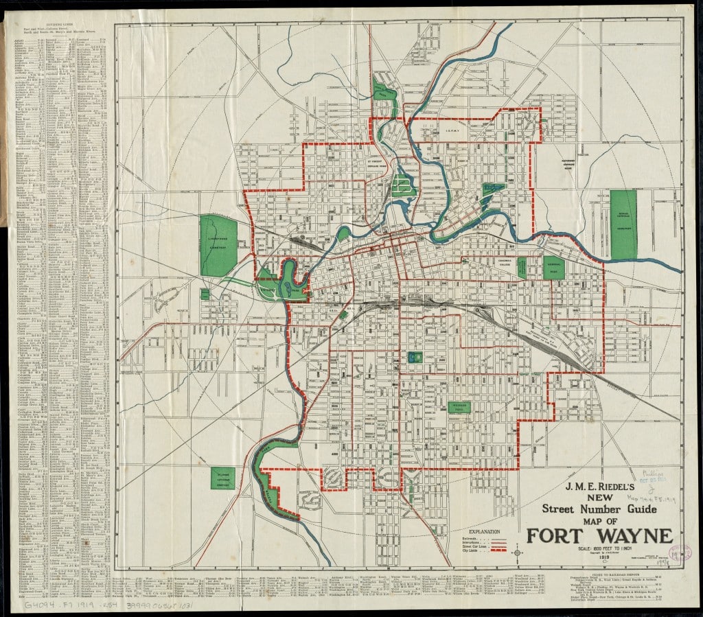
The history of Fort Wayne is the story of efficient and convenient transportation. As early as the founding of the country, President George Washington set control of the local portage between the Great Lakes and Mississippi watersheds — extending roughly from the St. Marys River near Swinney Park to the headwaters of the Little River — as a priority for the U.S. to control.
From there came a settlement that saw the construction of the Wabash-Erie Canal, which gave the Summit City its nickname, and, when the canal closed, a railroad was built on the former right-of-way. Other early projects spearheaded by residents like Samuel Hanna include the construction of plank roads, like Lima Road, which acted as early highways leading to nearby communities.
Fort Wayne was largely designed around the transportation available at the time. Local historian Creager Smith says that the prevalence of the grid system in earlier developments resulted from the ease of navigating a grid by foot, the dominant local mode at the time. Major changes, he explains, came when the streetcar expanded the geographic footprint of the city while still supporting relatively compact development patterns. Smith cites this as the beginning of local sprawl despite dense development patterns incentivized by the streetcar. That expansion happened because now, cheaper land at the peripheries of the city was accessible without a long journey from the city’s core.
“The streetcar system and the residential development sort of fed off of each other because the more exclusive, or the better neighborhoods, were linked to access to the streetcar lines,” Smith said in an interview with Input Fort Wayne, “but then also where the city grew — that’s linked to where you could extend the streetcar lines.”
Developers built along the streetcar lines, planning smaller property frontage along the rails and longer lots between neighbors so that more residents could be served per mile of streetcar line. High density developments resulting from the streetcar benefited developers and streetcar operators because more residents per mile meant more revenue per mile of building and tracks.
Then, in 1910, Charles Robinson presented the first broad strategy for designing Fort Wayne. Smith says that Robinsion noted the rise of the automobile and criticized some of the narrow spaces between developments for the potential to stifle Fort Wayne’s adoption of cars.
“Robinson pointed out a lot of these things, like plats that didn’t have streets that aligned with each other — that really didn’t make a big deal for walking, but it started to make a bigger deal as Robinson was seeing the increase of production of automobiles,” he explained.
Developers were not communicating and their plats often did not align or have the same name for adjoining roads.
“They were just doing what they wanted to do, and sometimes they paid attention to what the context was, and sometimes they didn’t.”
The Robinson plan would be more fully realized with the implementation of George Kessler’s 1912 Parks and Boulevards system.
Kessler’s system planned a series of grand boulevards that united uncoordinated subdivisions with large parks along the route. Rudisill and Anthony Boulevards were incorporated into the plan and helped to connect a rapidly developing city while maintaining the aesthetic beauty of its natural landscape.
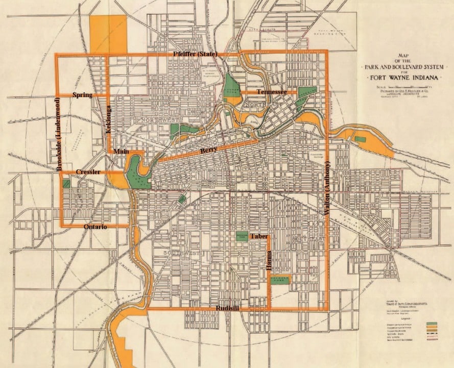
“It was a way to move in a circular way around the city rather than having to go through the center every time to get from one place to another,” Smith explains, “and that’s why there’s just so many early 20th-century neighborhoods in Fort Wayne that are really great neighborhoods still today because they were doing the same thing in 1918 that developers did in 1950 — that they were looking at the evolution of the transportation system and saying, ‘Okay, here’s where this is headed, and let’s take advantage of that.’”
While the streetcar had shaped Fort Wayne’s growth for decades, its dominance was beginning to fade. By the 1940s, aging infrastructure, declining ridership, and the flexibility of buses and trackless trolley coaches made maintaining the extensive rail network increasingly difficult. The city aimed to replace portions of the system in 1939, and the last streetcar ran in 1947. Without fixed rail lines guiding development, future growth became less tied to specific corridors and increasingly dependent on the automobile.
Car usage ticked up after World War I, leaned back into public transit during the Great Depression, then boomed after World War II.
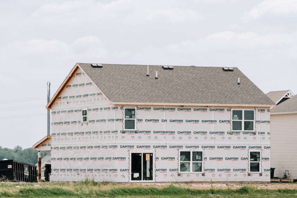
During this period, the United States saw the convergence of several innovations and trends. Fort Wayne’s population grew from approximately 45,000 residents in 1900 to more than 133,000 by 1950, and innovation made cars more affordable. All of these people needed homes, and now that cars could quickly navigate Fort Wayne’s grid, cheaper greenfield development away from Fort Wayne’s urban core became the obvious choice for developers and families. Now that people could travel more quickly, conveniently, and independently, shopping centers separated from residential development became more normal due to the economic efficiency enabled by vehicles, leading to the separation of land uses and lower-density development patterns prevalent today.
In the 1950s, officials built Coliseum Boulevard, then known as the Circumban Highway, to alleviate traffic by providing a bypass around the northern part of Fort Wayne. However, developers maintained the historical trend, and new neighborhoods began to spring up around the new bypass and its connected routes, like IN-37 and US-27. Proximity to the transportation “mode-of-choice” continued to attract residents and set development trends, discouraging density due to the speed of travel and economic efficiency.
Like the streetcar corridors before it, development followed the region’s newest transportation infrastructure. The final local trolley coach service was replaced by motor buses in 1960.
As part of this trend, developers began focusing on shopping centers rather than mixed-use development. Major centers like Glenbrook Square came in 1966 along Coliseum Boulevard, then concurrent with US-30, and Southtown Mall followed in 1969 along US-27. Unlike traditional neighborhood business districts, these centers were designed around regional automobile access rather than walking customers.
Neighborhoods closed to through traffic to protect residents from the sound and physical impacts of traffic near their homes, and the maneuverability of the automobile opened the door to expand the use of cul-de-sacs and plats that appear more “curvy” in contrast to the walker-friendly grids of the past.
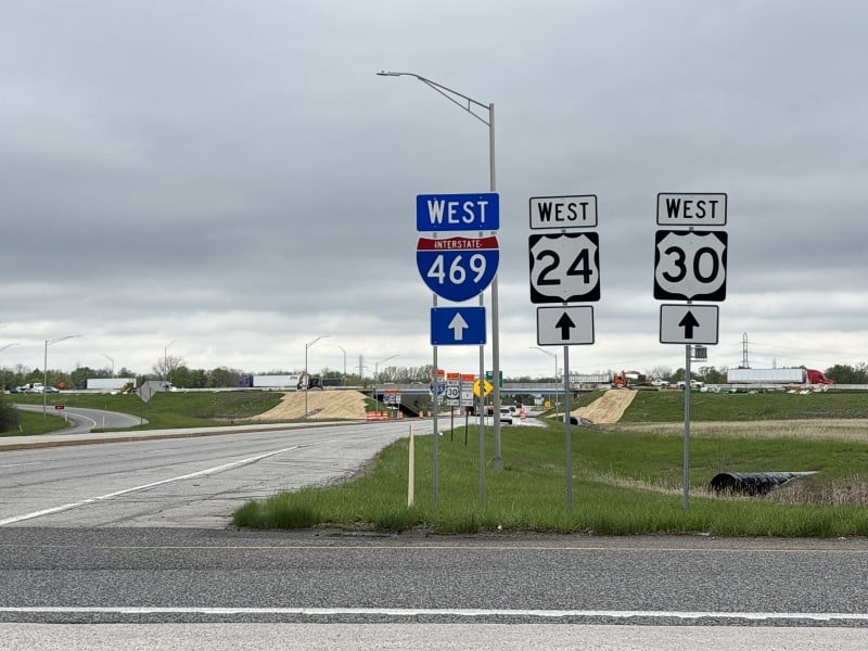
The federal government initiated the Interstate Highway System in 1956, and Fort Wayne became home to Interstate 69 around what was then the northwestern part of the city, allowing families with cars to conveniently travel the region.
Driving became easier, walking became harder, and transit became harder to maintain across longer distances, with not only fewer riders per mile of development, but also because transit no longer met the financial and convenience threshold now held by personal vehicles. Additionally, it’s generally cheaper for producers to sell goods from a few central locations instead of several neighborhood stores, continuing to reinforce the momentum of sprawling development.
The density issues that face building a robust transit or alternative transportation network were not solely the result of companies seeking economic efficiency, but rather a semi-organic convergence of cultural, economic, and technological trends and efficiencies from which public policies were later adopted. Even if the journey to this point was mostly natural, that does not mitigate the negative, perhaps unforeseen consequences of these trends.
Moving Fort Wayne Forward Reader Survey
Hey! We could really use your help making sure we can continue producing journalism that informs and inspires. Taking a few seconds to answer these questions will ensure we’re on the right track and that our funders understand our impact.
The resulting transportation system reflects the priorities, technologies, and economic realities of the generations that built it. Fort Wayne did not become a car-centric city because of a single policy decision, nor because its planners, developers, or residents intentionally set out to make future walkability and transit difficult. Rather, the city was built around the most efficient transportation available in the era.
Understanding this context helps to explain why some of the proposed solutions can be difficult to implement. Despite this, history suggests that development patterns are not fixed. Just as the right-of-way for trains became available because of the ultimate failure of the canal, the issues that Fort Wayne faces today are not insurmountable.
In making his 1910 report 116 years ago, Charles Robinson saw a community that “has now realized suddenly that a future, long permitted to look out for itself, has at last arrived … It has paused, taking account of these conditions, to learn what it can yet do to correct the omissions of the past and prepare for the assured future.”
Fort Wayne is once again at a moment of pause, learning what it can do to correct omissions of its past and prepare for the future. Transportation technology and local understanding of the future of Fort Wayne’s map continue to evolve, and the question becomes whether the city can adapt to an assured future once again.
Thanks to our Presenting Partner, Parkview Health, our Lead Sponsors, WindSwell Foundation and Community Foundation of Greater Fort Wayne, and to our sponsor, Citilink, for making this story possible.

Author

Related Articles
Can proximity solve a transportation problem?
Some developers, planners, and neighborhood advocates believe bringing destinations closer together could expand transportation choices.
How early introduction to alternative transportation could help change Fort Wayne’s car-centric mindset
Fort Wayne is a city with a car-centric mindset. Early exposure to biking and transit could help, but a lack of density could limit long-term habit change.
Reporter’s Notebook: Why transportation solutions in Fort Wayne can feel paradoxical
Joshua Schipper reflects on his transportation reporting, asking: Can you build a more walkable Fort Wayne if people don’t want to use it?