How improvements to wayfinding build confidence in trail users
Regional planners are expanding trail signage and wayfinding to help riders move beyond familiar routes and explore the network with confidence.
This story is part of Moving Fort Wayne Forward, a year-long reporting effort to engage residents, employers, and community leaders of Greater Fort Wayne around the possibility of a more modern, multimodal transportation system. Read the full series here.
When a group of teenagers approached Fort Wayne Trails Executive Director Kent Castleman at EcoFest last year, they told him they were not trail users. But when they mentioned that they usually hang out at Lawton Skate Park, Castleman pointed out that they were already using the trail system.
Moments like that illustrate a common challenge for Fort Wayne’s trail network: people often use parts of the network without realizing how the larger system fits together. For those who are not avid riders or runners, knowing when you are on a trail or how to navigate the larger network can be difficult. With an expansive and growing system, some users rely on memory or guesswork to figure out where they are going.
As the trails stretch further, planners are working to expand and standardize trail wayfinding devices across the region, not just within Allen County.
Theresa Minnich, a self-described casual trail user, says she navigates her usual routes by memory, but discovering new routes — or helping others find them — can be challenging.
“Especially when the trail turns from black asphalt to just a city sidewalk,” she says, it becomes harder for casual trail users to figure out where they are going, especially if they are unfamiliar with certain landmarks. “If I had to tell someone how to ride downtown, I’d first have to explain where Shoaff Park is.”
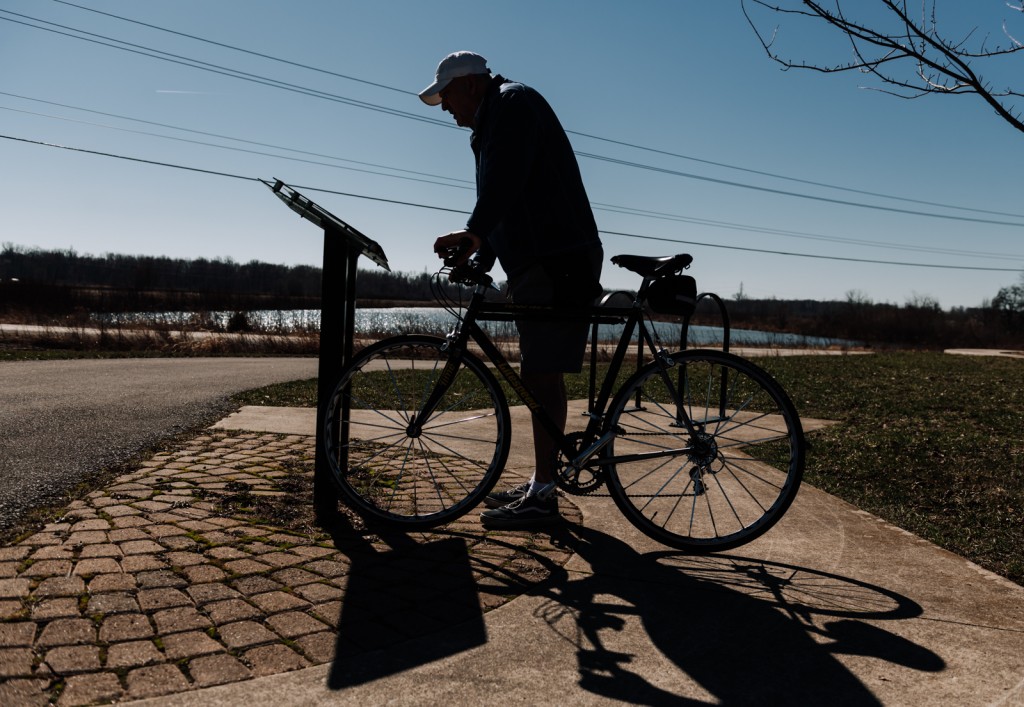
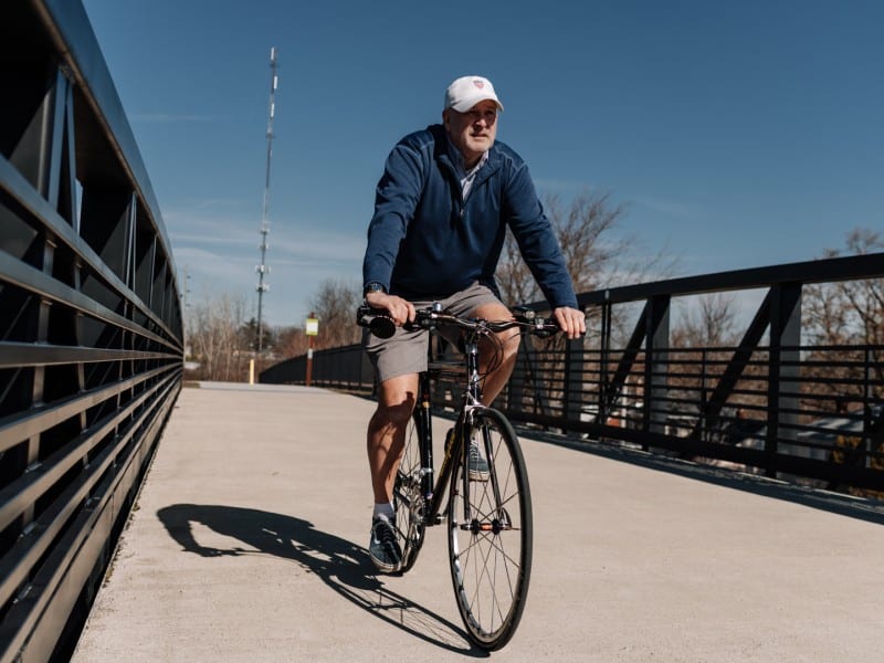
Roger Carroll Jr. is an avid user of local trails who regularly logs bike rides of 25 to 50 miles in a day, and he says that there is rarely a section of trail he does not know. However, when he takes newer cyclists out on the trails with him, he realizes that many lack confidence navigating the system, especially if they do not have easy trail access in their neighborhoods.
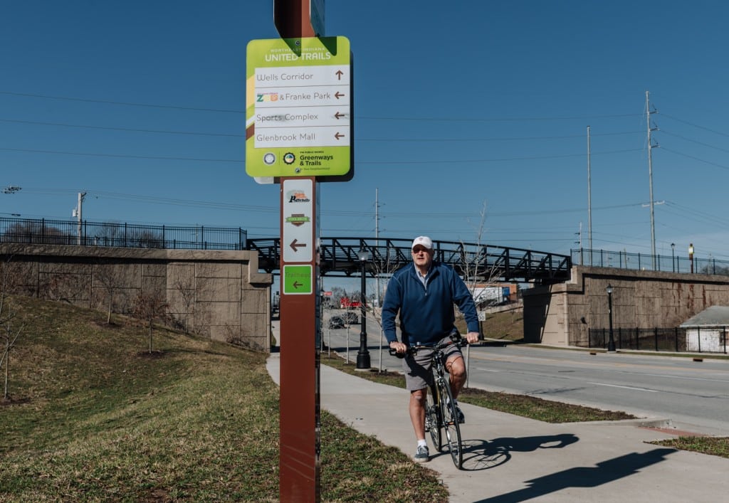
Often, he says, the first questions riders ask are where the trail goes and how far it continues. While trail wayfinding has improved over the past decade, and riders can find some information on signs along regional trails, coverage can vary depending on the trail segment.
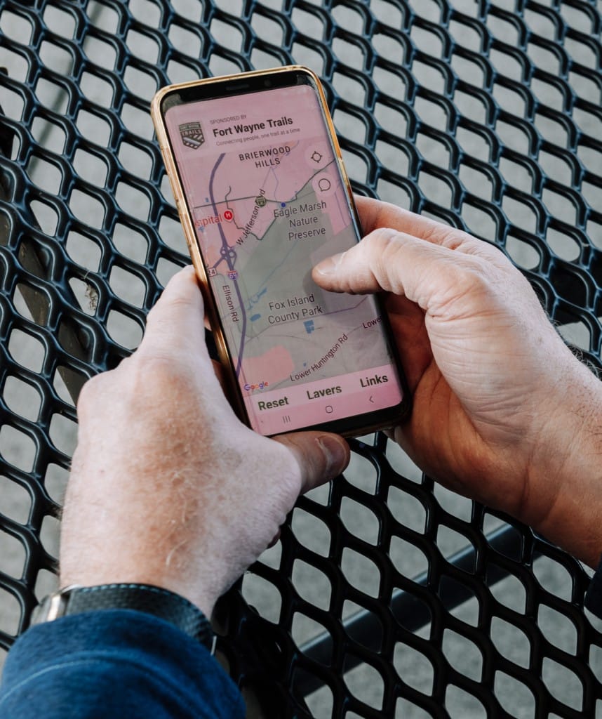
People already using the trails often rely on Google Maps or the Fort Wayne Trails app to find where they are going in lieu of physical signage. For inexperienced users, without clear and consistent signage on trails, it can be difficult to know where trails begin, where they lead, or even whether a nearby path is part of the system at all. Physical wayfinding helps people feel confident enough to try the trail system in the first place.
Uncertainty about where trails go can discourage people from exploring unfamiliar sections of the network entirely. Minnich says the only time she has discovered a new part of the trail is when her usual route has construction that forces her to go a different way.
Matt Peters, principal transportation planner for the Northeastern Indiana Regional Coordinating Council (NIRCC), oversees the regional rollout of standardized wayfinding tools, including trail signs and maps. Since adopting trail signage standards in 2017, Peters has overseen a gradual rollout of wayfinding devices designed to help residents more easily navigate the trail system.
For planners, the goal is to make the trail system easier to understand for people encountering it for the first time. By installing consistent signage, maps, and other wayfinding tools at key intersections, the regional plan aims to help users orient themselves, discover new routes, and better understand how the expanding network connects across communities.
According to Peters, standardization and branding are key to building confidence in using the trail system. Consistent signage, he says, helps residents recognize trails and quickly understand where they lead, like how road signs are standardized across different states.
Other cities have seen similar benefits from investing in clear trail identity and wayfinding. In Indianapolis, the eight-mile Indianapolis Cultural Trail includes standardized signage, branded pavement markings, and maps designed to help users understand how the network connects neighborhoods.
After the trail opened, a U.S. Department of Transportation case study found that the corridor saw a “significant increase in pedestrian and bicycle traffic”, suggesting that these clear infrastructure and navigation cues — coupled with some traffic calming improvements — can encourage more people to recognize and use trail networks.
While regional standardization can improve trail use, NIRCC only sets the standards. Municipalities must fund and install the signage themselves, which can slow how quickly improvements are implemented.
“Even Fort Wayne, they have a limited budget, and it’s hard to justify spending a bunch of money on trail signs when there’s so many other things they’ve got going on. And so that’s been the struggle — finding the money, the funds — to put these in system-wide.”
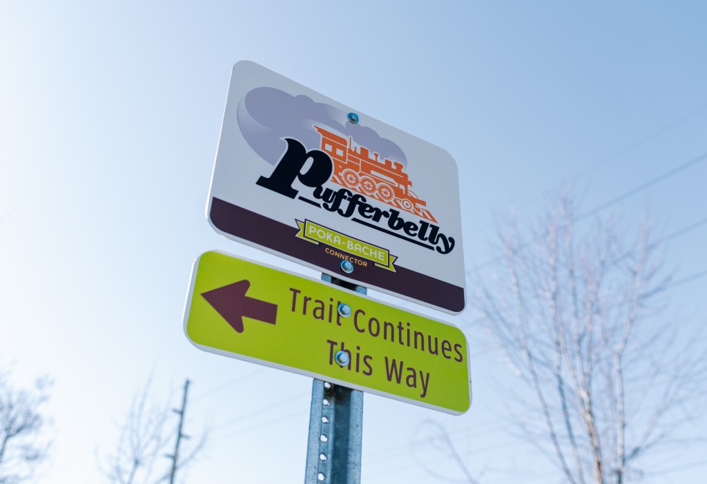
While incomplete, Peters says that the region continues to see progress in helping trail users find their way since the project’s origin in 2013. At that time, a group worked with a consulting firm to standardize the name of the Poka-Bache Trail, which had been referred to by different names as it crossed multiple municipalities.
This, Peters says, “got everything jump-started for this regional system.”
“We’ve been installing signs since 2017, and we’ve changed and evolved a little bit since then. Anytime we get input, we use it to help evolve our signage too.”
In addition to physical signage, planners and trail advocates have explored digital tools that can help users understand how the network works. Physical signage is limited by space, but adding QR codes allows users to access more detailed trail information.
“[It] will take you right to a web page that shows you where you are,” says James Holm, director of community engagement for Fort Wayne Trails. “It’ll give you distances to all the locations that are listed on the signage. It’ll give you specific trail information. It’ll show you where bathrooms, trail-friendly businesses, all that stuff is.”
While those tools can help riders already on the trail, the physical signage system remains the backbone of regional wayfinding. Clear signs and recognizable branding help users understand where they are within the network without needing to rely entirely on their phones, memory, or guesswork.
In March, the Fort Wayne Redevelopment Commission approved a $1.1 million construction contract to continue construction on the local Urban Trail using tax increment financing, which does not require city council approval — unlike previous attempts to continue construction. Castleman hopes the branding of the Urban Trail can have a similar effect to Indianapolis’ Cultural Trail.
“You know you are on the Cultural Trail in Indianapolis — it is in your face at every intersection that you are on the cultural trail, and so we really are pushing for that side of it.”
Moving Fort Wayne Forward Reader Survey
Hey! We could really use your help making sure we can continue producing journalism that informs and inspires. Taking a few seconds to answer these questions will ensure we’re on the right track and that our funders understand our impact.
For casual riders like Minnich, clearer navigation could make it easier to move beyond the routes they already know.
As the trail system expands, planners hope improved signage and wayfinding will give residents the confidence to try trails they might otherwise pass by.
For some riders, that confidence may turn a routine ride into an opportunity to discover somewhere new.
Thanks to our Presenting Partner, Parkview Health, our Lead Sponsors, WindSwell Foundation and Community Foundation of Greater Fort Wayne, and to our sponsor, Citilink, for making this story possible.
Author

Related Articles
Pedals, paths, and people: Riders share their experience on Fort Wayne trails
Fort Wayne riders say familiarity, etiquette, and experience shape how comfortable people feel navigating the region’s expanding trail network.
CTN puts out urgent call for new drivers as new funding boosts capacity
A new grant offers the opportunity to increase the number of rides Community Transportation Network (CTN) offers, but they need to fill seven vacant driver positions to make it happen.
What do Citilink’s route changes mean for Southeast Fort Wayne?
Officials say the changes, which took effect in early March, will provide more predictable and direct service in the quadrant.