Over the past 50 years, the average annual temperature has increased by one degree each year, according to the
Midwestern Regional Climate Center (MRCC). This warming effect is further showcased by reports that temperatures are getting warmer earlier each year. But it's not just the peak of high temperatures warming up, when it comes to temperature lows, in June, Fort Wayne set a new record for four consecutive days of new warm low temperatures.
In short, summers are getting hotter and winters are getting warmer. Those new highs and lows can create problems, especially in cities like Fort Wayne, where hot temperatures can create an urban heat island effect, or spots within the city that reach much higher temperatures than the surrounding rural areas.
Urban heat islands can be created by buildings, pavement, and other surfaces that absorb and retain heat, making the areas around them much warmer. A lack of natural land cover, like trees, can also directly affect urban heat islands.
Extreme heat, like those found in urban heat islands, can create a multitude of problems, especially for vulnerable populations. But it can be difficult to address those urban heat islands without knowing exactly where they are and what solution would best address them. To help figure this out, The City of Fort Wayne is embarking on an Urban Heat Island (UHI) mapping campaign.

![]() Rachel Von StroupBernadette Fellows
Rachel Von StroupBernadette FellowsBernadette Fellows, a community engagement planner for the City of Fort Wayne is helping organize the campaign along with Dan Baisden, community development administrator. Both are part of the Neighborhood Planning and Activation Workgroup, Fellows says their team engaged with City Utilities and the Office of Sustainability last year to be more comprehensive in their work with neighborhoods.
“We wanted to see where we could plug in and work together and collaborate, and as we were doing that we came across research about this heat grant and we started realizing this would be such a good impact for our community,” she says. “It would really help us as a team to move forward and give people good information that can be useful for their neighborhood.”
Fellows says the data could lead to identifying problems that were previously unnoticed.
“Looking at all the infrastructure proactively and seeing what causes the biggest impact because we think theoretically that the areas that are most green are probably going to be coolest, but that may not be the case,” she explains. “That's why it's important to do actual field research because you never know if there's some weird underlying factor that's going to give us an odd result. We want to make sure that we give real results and practical solutions to our neighborhoods.”
![]() Rachel Von StroupDan Baisden
Rachel Von StroupDan BaisdenShe says the process of collecting this sort of data is long but can help create tangible change in the community and help identify potential resources for areas that need them.
“One of our top goals is to improve quality of life for residents across the community,” Baisden explains. “So there are the obvious ways of improving quality of life, whether it be parks and playgrounds and sidewalks and street improvements and businesses and economic development, but there's also having that baseline research that helps us create projects that really do have a direct impact on improved health, wellbeing and overall quality of life.”
It goes beyond the infrastructure too. Fellows and Baisden say it can help the city better understand how heat and air quality impact neighborhoods, which can help them address social determinants of health for Fort Wayne residents.
“How do we show people the real impacts of their built environment being the way it is?” Fellow asks. “And that's what this study allows us to do.”
So what exactly is an Urban Heat Island mapping campaign and how does it work?
It started with a competitive application process, Fort Wayne was one of 14 cities selected for the 2024 National Oceanic and Atmospheric Administration (NOAA) Urban Heat Island mapping campaign. Through this federal grant, the City was connected with
CAPA Strategies, which helps plan the mapping process and provides the necessary equipment, and the
National Weather Service, which will help determine which day the mapping process should take place.
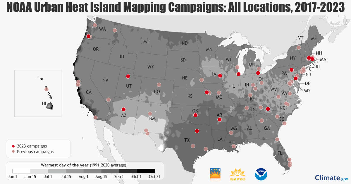
![]() Courtesy of CAPA StrategiesCities that have completed Urban Heat Island mapping.
Courtesy of CAPA StrategiesCities that have completed Urban Heat Island mapping.Fellows says the data-gathering process is “both very simple and also somewhat complicated.”
To map out heat islands, drivers are sent out on predetermined routes three times over the course of a single day, with sensors attached to their vehicles. The routes were designed by CAPA Strategies and were based on 50 points of interest provided by the City of Fort Wayne.
“Those are selected based on areas where we know people will congregate or areas like parks, schools– areas we know people spend time outside,” Fellows explains. “Frequent walking routes in neighborhood areas and also in a variety of settings like some industrial areas, some major business corridors. We've tried to have a really good mix and then those were sent off to CAPA Strategies.”
To make this happen,
the City is reliant on volunteers, which they’re still recruiting. Fellows says they need three types of volunteers– drivers, navigators, and logistics assistants.
Drivers will be driving a 1-hour, predetermined route in their car with the sensor attached, but they will need to be available for 2 hours total so they can collect and return their sensors. Navigators will be directing drivers through the route and making note of any events along the route that may alter their data. Fellows says the navigators are an important part of the campaign because the routes don’t necessarily follow the most efficient traffic route, so a GPS would not provide consistent directions. Plus, it allows drivers to focus on driving, not the route or the sensor.

![]() Courtesy of CAPA StrategiesA heat sensor from CAPA Strategies attached to a car in Utah.
Courtesy of CAPA StrategiesA heat sensor from CAPA Strategies attached to a car in Utah.“Then we have our logistics volunteers, who are just going to be at the hub site to help us with the placement of the sensors and receiving of the sensors because we're going to have about 10 cars coming in at one time since they're going to start at the same time and come back at the same time,” Fellows explains. “We want to make sure that we have people who can help safely and quickly collect those monitors and troubleshoot any issues.”
All volunteers must provide a valid ID and a signed waiver. Drivers must provide their driver’s license, proof of auto insurance, and the signed waiver. Additionally, all volunteers must complete a quick training webinar that explains the whole process.
The process thus far is relatively straightforward, but here is where it gets complicated. Fellows says the campaign has to be completed on a day when the weather meets certain criteria. While weather is a science, it can also change quickly, which means the date of the campaign can’t be set too far in advance. This is where the National Weather Service steps in to assist.
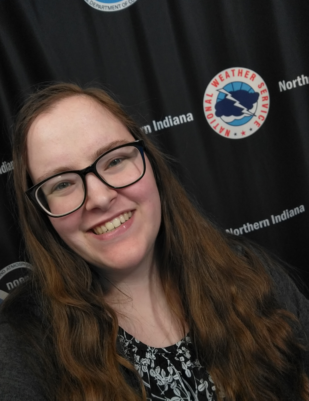
![]() CourtesyMaddi Johnson, a meteorologist with the National Weather Service Northern Indiana Office
CourtesyMaddi Johnson, a meteorologist with the National Weather Service Northern Indiana OfficeMaddi Johnson is a meteorologist with the National Weather Service Northern Indiana Office and she’s working with the City to determine the best day to run the heat mapping campaign. She says they provided historical records of weather data from the past couple of decades to help narrow down the best windows of time.
“What we’ve done to help the City of Fort Wayne is we gave them certain windows in the summer when we normally have hot and dry conditions because that’s the kind of ideal weather pattern that they want,” Johnson explains.
It comes are no surprise the best times to meet those conditions are in July and August. The city’s team determined that the campaign will take place sometime before July 7 and July 12.
As those dates get closer, Johnson and meteorologists from the National Weather Service will begin giving daily weather briefings and outlooks to help identify the best day during that week to run the campaign.
“If we want to see really how bad these urban heat islands are, hot and dry are the conditions we need to map,” Fellows says. “So between working with the National Weather Service and finding the ideal window and then having these special sensors from CAPA Strategies that are built to map these conditions, ultimately CAPA Strategies will take the ground level data we collect and they’re going to overlay it with meteorological data, the actual satellite data.”
Determining the date late in the game is best for data collection, but presents a problem for Fellows and her team who are recruiting residents to help. As a solution, volunteers can input their availability based on time slots for each day during the potential campaign window. To fill gaps, organizers are hoping to have more volunteers than they need.
“I would love to have at least 100 registered,” Fellows says. “Of course, life happens, people have emergencies, people fall ill, accidents, cars stop working– I would much rather we have a multitude of volunteers and we’re totally ready to go.”
For Fellows, she views this as more than a project– this is a historic moment for the city, one that anyone willing and able can take part in.
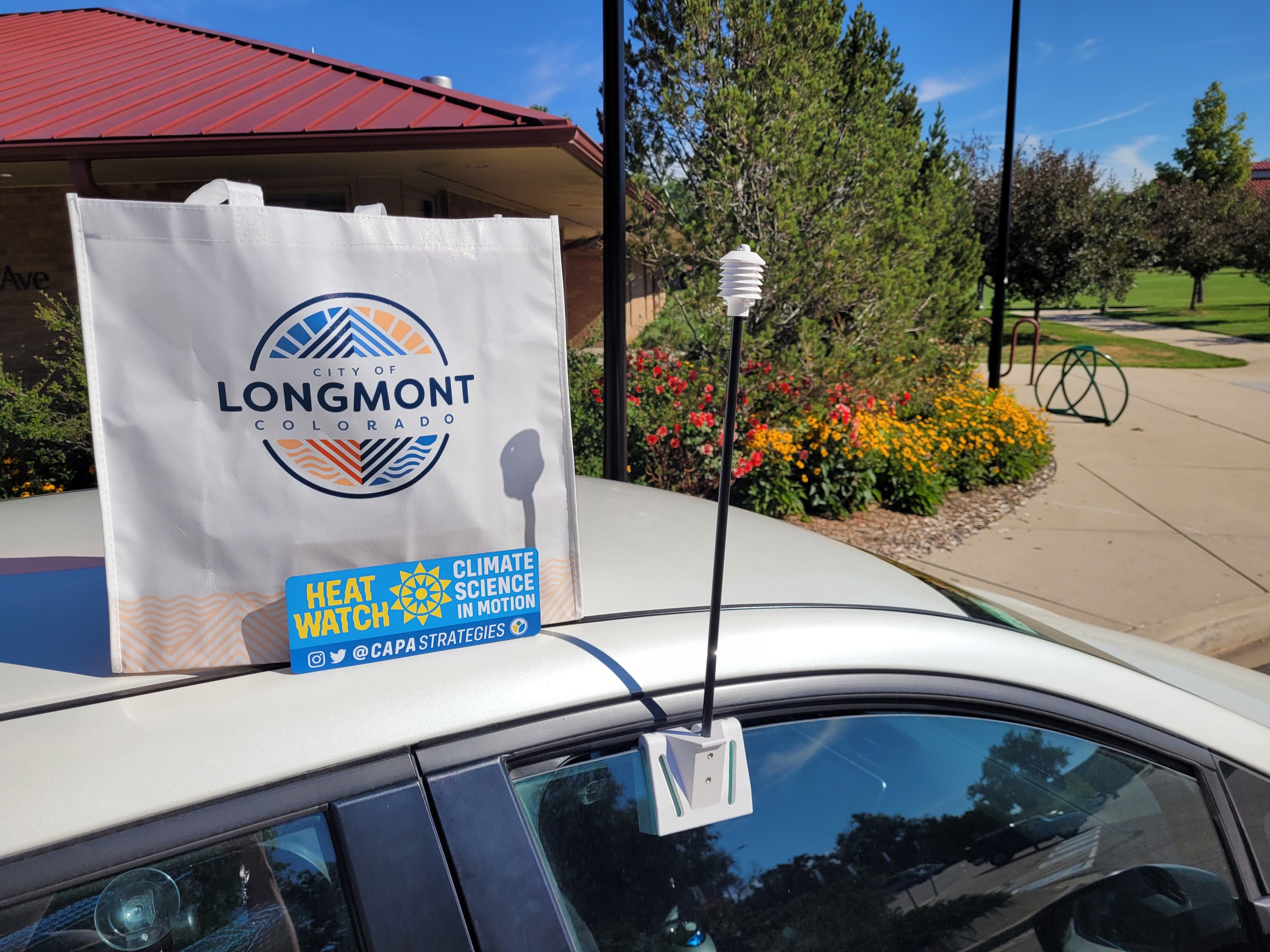
![]() Courtesy of CAPA StrategiesA heat sensor from CAPA Strategies attached to a car in Colorado.
Courtesy of CAPA StrategiesA heat sensor from CAPA Strategies attached to a car in Colorado.“We are going to use this data to make lives better for not only yourself but your children and your children's children,” she says. “We need to make sure that we as a city understand what's going on…We need to be proactive before there's a problem.”
But how does the collected data translate into tangible changes in Fort Wayne?
After the campaign is completed, the collected data is sent back to CAPA Strategies, which packages it into a report. The process takes about 8 to 12 weeks. From there, it will be shared with different departments throughout the city, who can use it to make informed decisions about infrastructure and policy.
The report will also be available to the public on
Engage Fort Wayne’s website, which Fellows says will help put that data into the hands of neighborhoods and help residents understand how they’re being impacted by their environment.
Neighborhoods can then use the data to help secure funding, like grants, to make changes that could improve quality of life, such as increased tree canopies or cooling stations.
“They will have the data to back it up,” she says. “They can share, ‘We are one of the hottest areas. We need a cooling station or we should make park improvements because the reason people won't go to the park is it's 105 degrees due to the lack of tree cover.’ So it should be a really empowering tool.”
Organizers of the campaign are hopeful the City will be able to provide a larger rollout of this information by next spring, where they can implement what they’ve learned from the study, which could include addressing the city’s emergency heat management and providing tools to neighborhoods of concern.
“I think the most important takeaway is that this is a chance for us to have some really important data that we can use to make well-thought-out, well-researched decisions in the future,” Baisden says.
For more information on the Heat Island Mapping Campaign,
visit Engage Fort Wayne.